
| THE ADVENTURES OF PLATY AND THE GANG |
|
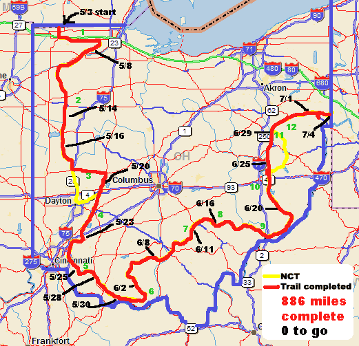
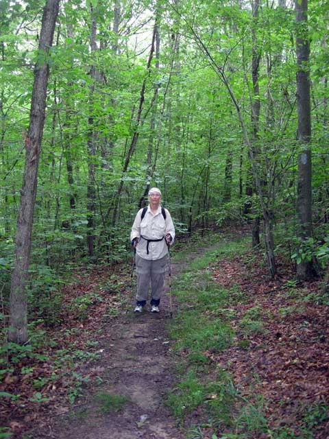
Hiking in Ohio- 2010 |
|
|
|
| Platty's Home Page | Go to Current Year | Go Back One Page |
(click on pictures for a larger view)
 Judy
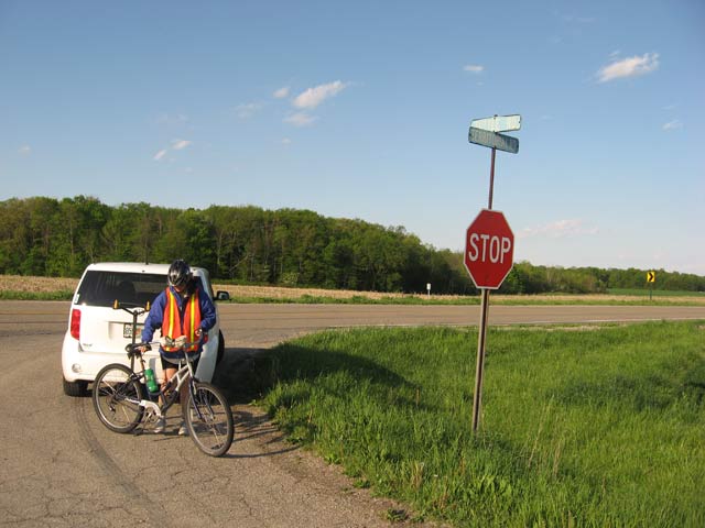
started by biking south the first section at the spot where she had started
in 2008 going north. The first 8 miles was on roads.
Judy
started by biking south the first section at the spot where she had started
in 2008 going north. The first 8 miles was on roads.
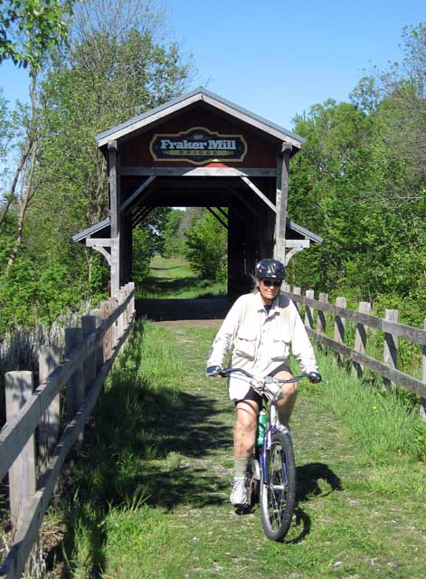
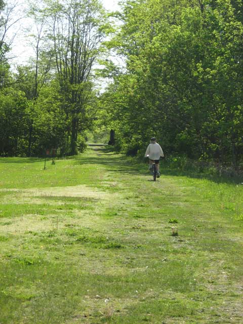 In
Wauseon she connected with the
Wabash Cannonball Trail.
In
Wauseon she connected with the
Wabash Cannonball Trail.
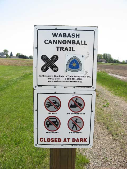 It
is cinders in some areas, paved in some, and mud puddles in others.
It
is cinders in some areas, paved in some, and mud puddles in others.

 It's
been very wet in this area and the trail was under water. She tried hiking
around the wet area but slipped and got her feet wet in the swamp. After leaving
the park she had a short one mile section through the Maumee State Forest on a
service road. Easy, right? No, the area had a network of grass roads
with blazing like we saw in Canada. Put the blaze in the middle of the
fork and don't indicate which is the correct path. Well, she walked about
three miles in a circle and ended up back at the beginning. The second
time around she found the correct path. Once she was back on the Wabash
rail trail she switched to the bike and had a flat tire. Not a good day!!!
It's
been very wet in this area and the trail was under water. She tried hiking
around the wet area but slipped and got her feet wet in the swamp. After leaving
the park she had a short one mile section through the Maumee State Forest on a
service road. Easy, right? No, the area had a network of grass roads
with blazing like we saw in Canada. Put the blaze in the middle of the
fork and don't indicate which is the correct path. Well, she walked about
three miles in a circle and ended up back at the beginning. The second
time around she found the correct path. Once she was back on the Wabash
rail trail she switched to the bike and had a flat tire. Not a good day!!! While
in the area we visited
Sauder Village. You may recognize the name. They are a big
manufacturer of furniture. We actually went there twice just to eat at
their restaurant.
It's a 1861 barn that was moved 2 miles and converted to a restaurant in 1974.
It has a home style buffet that I went off my diet for. Judy was good and
stuck to hers and had soup and salad.
While
in the area we visited
Sauder Village. You may recognize the name. They are a big
manufacturer of furniture. We actually went there twice just to eat at
their restaurant.
It's a 1861 barn that was moved 2 miles and converted to a restaurant in 1974.
It has a home style buffet that I went off my diet for. Judy was good and
stuck to hers and had soup and salad. The
North Country Trail in Ohio
follows the Buckeye Trail when ever
possible. The Buckeye Trail (BT) travels around the entire state in a big
circle. The North Country Trail (NCT) for some unknown reason has chosen
to follow the BT down the western side, across the southern side and back up the
east side of the state rather than just following the northern portion of the
trail directly to Pennsylvania.
The
North Country Trail in Ohio
follows the Buckeye Trail when ever
possible. The Buckeye Trail (BT) travels around the entire state in a big
circle. The North Country Trail (NCT) for some unknown reason has chosen
to follow the BT down the western side, across the southern side and back up the
east side of the state rather than just following the northern portion of the
trail directly to Pennsylvania.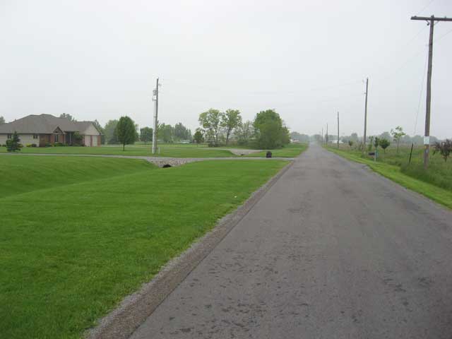 Sometimes
all that remains is a ditch in someone's yard.
Sometimes
all that remains is a ditch in someone's yard.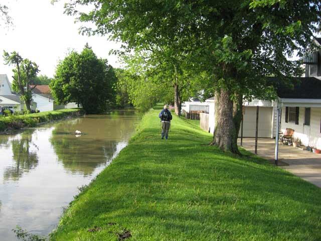 The
longest is a 40 mile section of
hiking trail from Delphos to Fort Loramie. It starts out in back yards
and travels along the edge between the canal and fields.
The
longest is a 40 mile section of
hiking trail from Delphos to Fort Loramie. It starts out in back yards
and travels along the edge between the canal and fields.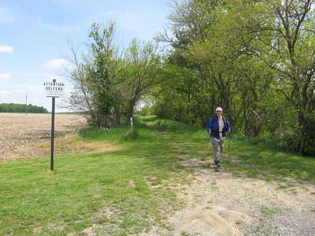
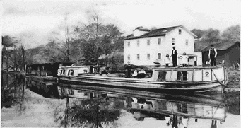
 The canal was the reason some of the adjoining towns came into existence and
they now have created historical displays to preserve and inform. Some are
quite elaborate and impressive. New Bremen has reconstructed the lock and
lockmaster's house in a beautiful park that is the centerpiece of downtown.
The canal was the reason some of the adjoining towns came into existence and
they now have created historical displays to preserve and inform. Some are
quite elaborate and impressive. New Bremen has reconstructed the lock and
lockmaster's house in a beautiful park that is the centerpiece of downtown.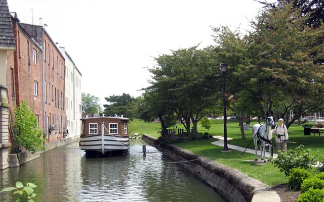
 Saint
Marys has torn down buildings that were built over the canal and reconstructed
the waterway under the street and have a included a canal boat and the mule that
Judy is standing next to. You can see, however, that the canal dead ends
behind the boat where it was filled in for another street.
Saint
Marys has torn down buildings that were built over the canal and reconstructed
the waterway under the street and have a included a canal boat and the mule that
Judy is standing next to. You can see, however, that the canal dead ends
behind the boat where it was filled in for another street.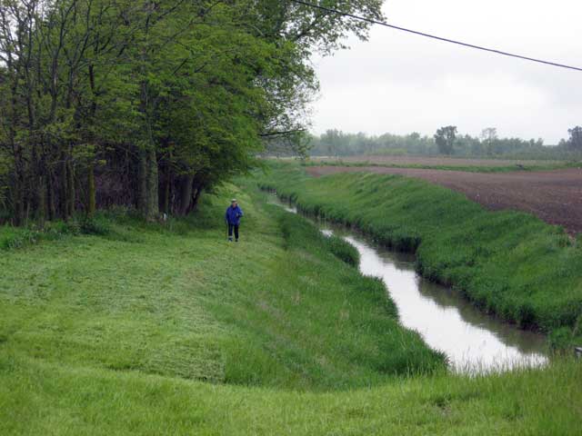
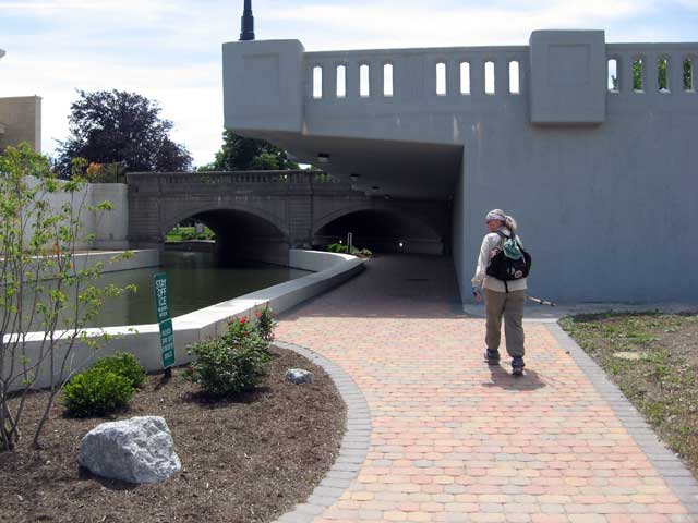
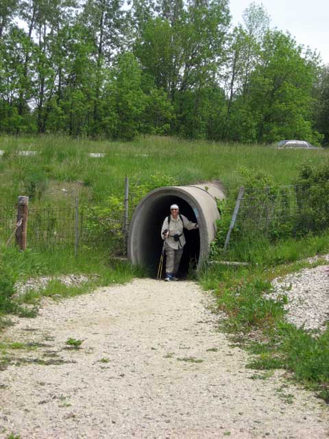 In
between the towns the trail follows what is left of the canal when possible.
In areas where it has lost out to progress there are either road walks or
innovative ideas like a culvert tunnel where a divided highway has cut it's
path.
In
between the towns the trail follows what is left of the canal when possible.
In areas where it has lost out to progress there are either road walks or
innovative ideas like a culvert tunnel where a divided highway has cut it's
path.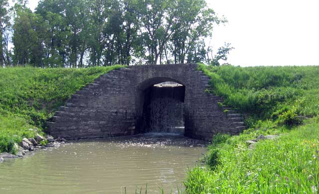 Some
of the other structures besides locks have been also preserved. A aqueduct
is a bridge to allow the canal to cross over an object like the creek in this
picture. The canal travels from left to right above the creek that is the
water seen here under the canal. This one also has a weir that regulates
the level of water in the canal forming the waterfall.
Some
of the other structures besides locks have been also preserved. A aqueduct
is a bridge to allow the canal to cross over an object like the creek in this
picture. The canal travels from left to right above the creek that is the
water seen here under the canal. This one also has a weir that regulates
the level of water in the canal forming the waterfall. 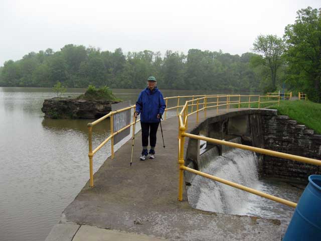 Sometimes
lakes were constructed to supply water to keep the canal full.
Sometimes
lakes were constructed to supply water to keep the canal full.
 Once she reached Piqua, Judy decided to alter her route from the Buckeye Trail
route and go straight to Urbana and connect with the
Simon Kenton Trail.
This connects with the Little
Miami Scenic Trail in Springfield and on south to Milford. The detour
would allow her to utilize the entire portion of the LMRST that is certified by
the NCT without backtracking.
Once she reached Piqua, Judy decided to alter her route from the Buckeye Trail
route and go straight to Urbana and connect with the
Simon Kenton Trail.
This connects with the Little
Miami Scenic Trail in Springfield and on south to Milford. The detour
would allow her to utilize the entire portion of the LMRST that is certified by
the NCT without backtracking.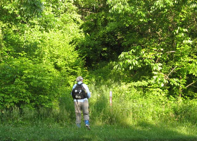 East Fork State Park is one of the largest Ohio State Parks with 4,870 acres.
The land is leased from the Corps. of Engineers who own it along with the 2,000
acre William H. Harsha Lake it
ajoins.
East Fork State Park is one of the largest Ohio State Parks with 4,870 acres.
The land is leased from the Corps. of Engineers who own it along with the 2,000
acre William H. Harsha Lake it
ajoins.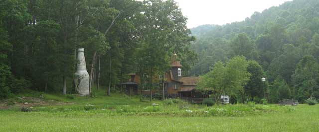 On
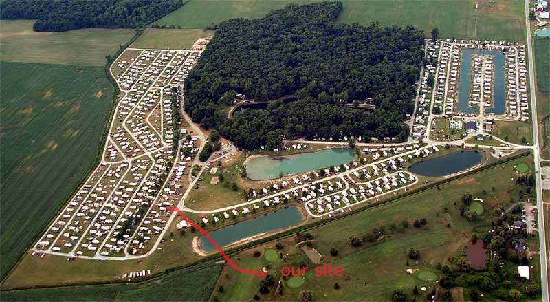
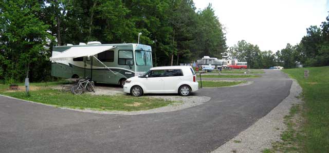
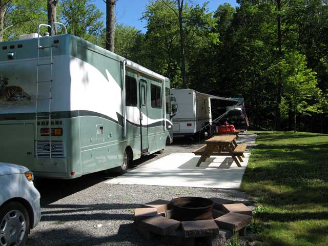
5/31 we moved to Lazy Village Campground
in Portsmouth, Ohio (number 6 on the map).
It was a racetrack in the 60's that has been converted into a campground and is
under new management. It's a clean friendly spot to stay for a week.
On
5/31 we moved to Lazy Village Campground
in Portsmouth, Ohio (number 6 on the map).
It was a racetrack in the 60's that has been converted into a campground and is
under new management. It's a clean friendly spot to stay for a week.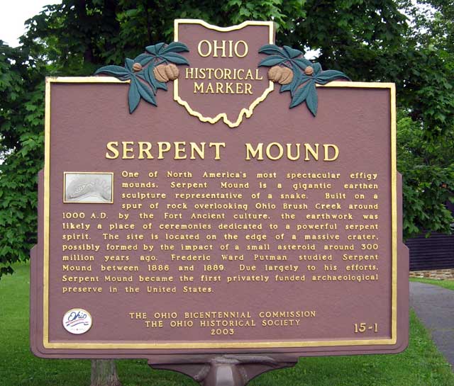 The
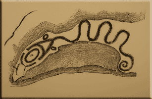
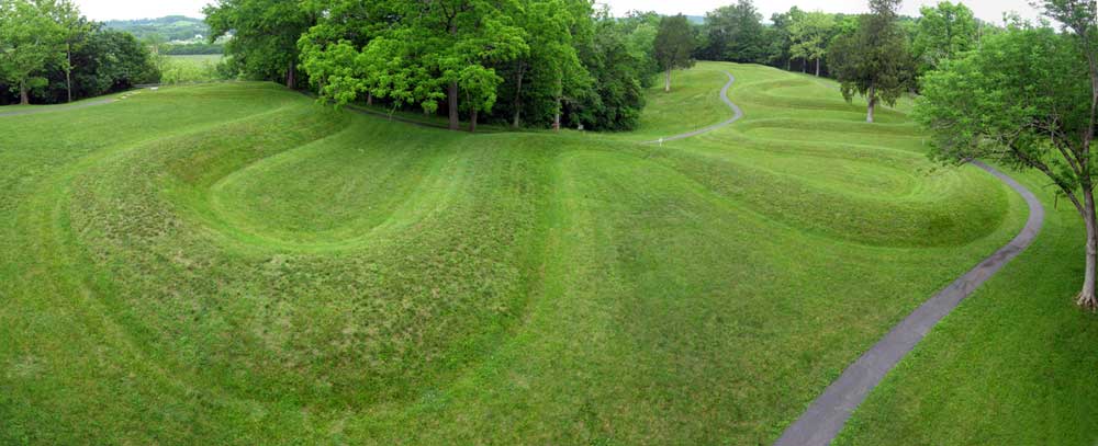
trail does go through the
Serpent Mound park.
The
trail does go through the
Serpent Mound park.
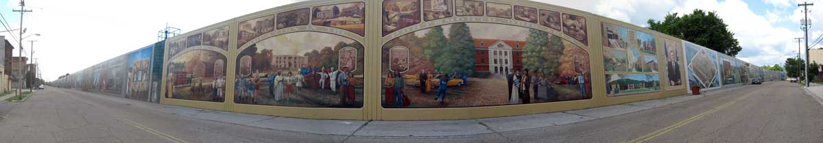
 When
we first arrived at Portsmouth the campground manager told us to definitely go
see the 'murals'.
We had no idea what she was talking about. Finally on our last day, after
lunch we followed the signs and visited the 'murals'. Wow! They are huge,
over 2000' long covering the entire floodwall. On the right side of the
picture you can see a scaffold where the artist is working on it. He
started in 1993.
When
we first arrived at Portsmouth the campground manager told us to definitely go
see the 'murals'.
We had no idea what she was talking about. Finally on our last day, after
lunch we followed the signs and visited the 'murals'. Wow! They are huge,
over 2000' long covering the entire floodwall. On the right side of the
picture you can see a scaffold where the artist is working on it. He
started in 1993.
 One of the do-able hiking sections is Fort Hill State Memorial.
I dropped her off and drove to the other end in the park. I then hiked in
from that end to meet her. After about 3/4 of a mile I tried calling on
the radio but got no answer. I decided to turn around and walk slowly and
let her catch up. The next thing I hear was her calling me asking where I
was. She had made a wrong turn and walked around the other side of the
park and was waiting at the car.
One of the do-able hiking sections is Fort Hill State Memorial.
I dropped her off and drove to the other end in the park. I then hiked in
from that end to meet her. After about 3/4 of a mile I tried calling on
the radio but got no answer. I decided to turn around and walk slowly and
let her catch up. The next thing I hear was her calling me asking where I
was. She had made a wrong turn and walked around the other side of the
park and was waiting at the car. 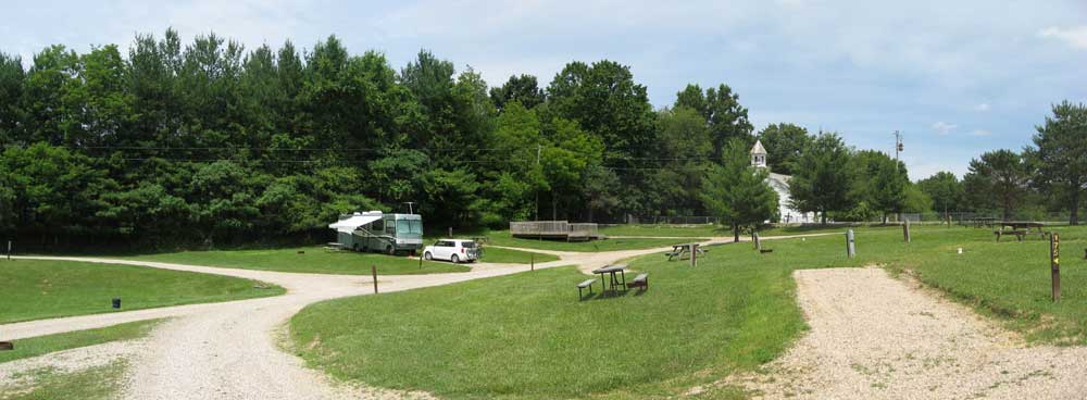 On
6/7 we moved to the Top o' the Caves
Campground (#7 on the map).
We got ahead of ourselves and had to drive back 64 miles the next day for biking
but will soon catch up. Tourism is really down in this area. We just
about have the campground to ourselves.
On
6/7 we moved to the Top o' the Caves
Campground (#7 on the map).
We got ahead of ourselves and had to drive back 64 miles the next day for biking
but will soon catch up. Tourism is really down in this area. We just
about have the campground to ourselves. 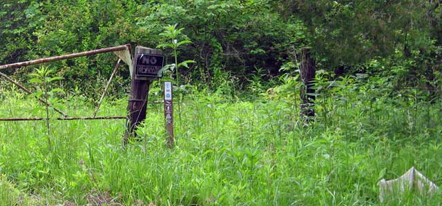
 In one area of the road section
between Fort Hill and Hocking Hills there was a bridge under construction and the road was closed.
I talked to the workers and asked if she could go across rather than doing a 14
mile detour. They sure saved her from a lot of extra miles!!
In one area of the road section
between Fort Hill and Hocking Hills there was a bridge under construction and the road was closed.
I talked to the workers and asked if she could go across rather than doing a 14
mile detour. They sure saved her from a lot of extra miles!! The trails in the
Hocking Hills State Park are really nice. They are are more developed
and maintained and get a lot of use. There are numerous bridges and
tunnels in the gorges and lots of steps. The caves and waterfalls attract
a lot of tourists.
The trails in the
Hocking Hills State Park are really nice. They are are more developed
and maintained and get a lot of use. There are numerous bridges and
tunnels in the gorges and lots of steps. The caves and waterfalls attract
a lot of tourists.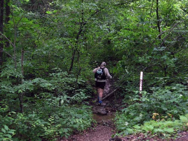
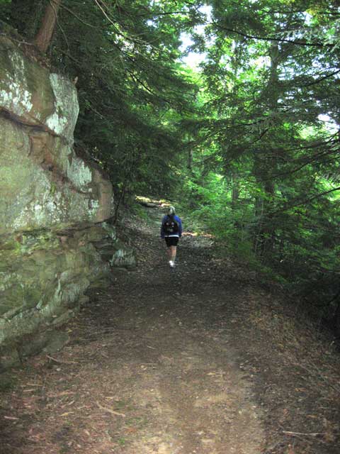
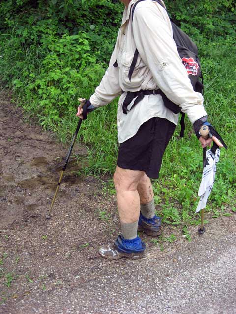 The area after the tourist section is another story. It's a bridle trail that is muddy, full of horse manure, overgrown and has blow-downs that have been there for years.
The mud was over her shoes and she almost lost them or fell in several places.
The downed trees had been there long enough that the horses had made new trails
but since there were no blazes she couldn't follow them and had to climb through
them. In other areas the thorn bushes were overgrown the trail tearing skin and
clothes. I guess horses don't mind them?
The area after the tourist section is another story. It's a bridle trail that is muddy, full of horse manure, overgrown and has blow-downs that have been there for years.
The mud was over her shoes and she almost lost them or fell in several places.
The downed trees had been there long enough that the horses had made new trails
but since there were no blazes she couldn't follow them and had to climb through
them. In other areas the thorn bushes were overgrown the trail tearing skin and
clothes. I guess horses don't mind them?
 On
6/14 we moved to the campground at
Burr Oak State Park .(#8 on the map). They recently added electric to 17 sites here but
still no water. What's up with that?? Don't people in Ohio use
water? The sites are also small and tight to get into and the dump station
is a back in. Not too good of planning there.
On
6/14 we moved to the campground at
Burr Oak State Park .(#8 on the map). They recently added electric to 17 sites here but
still no water. What's up with that?? Don't people in Ohio use
water? The sites are also small and tight to get into and the dump station
is a back in. Not too good of planning there.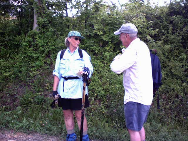 We
stayed in Marietta at the county
fairgrounds(#9 on the map). . It wasn't a resort by any means, a large paved parking lot
with posts with hookups around the outer edge. It was cheap enough,
$20/night for water, sewer, and 50 amp. Jerry Groebe arrived from Michigan
to spend a week hiking so Judy had someone to talk to.
We
stayed in Marietta at the county
fairgrounds(#9 on the map). . It wasn't a resort by any means, a large paved parking lot
with posts with hookups around the outer edge. It was cheap enough,
$20/night for water, sewer, and 50 amp. Jerry Groebe arrived from Michigan
to spend a week hiking so Judy had someone to talk to.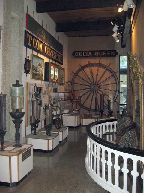 While
in Marietta we visited a couple of museums run by the Ohio Historical Society. We had
visited the Ohio
River Museum over 25 years ago while vacationing on our boat. It has an
extensive collection of steamboat memorabilia including the whistles shown in
the picture. The paddle wheeler W. P. Snyder, Jr. was in drydock
for extensive renovations, a new bottom, and was not on display.
While
in Marietta we visited a couple of museums run by the Ohio Historical Society. We had
visited the Ohio
River Museum over 25 years ago while vacationing on our boat. It has an
extensive collection of steamboat memorabilia including the whistles shown in
the picture. The paddle wheeler W. P. Snyder, Jr. was in drydock
for extensive renovations, a new bottom, and was not on display.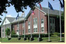 We
also visited the Campus
Martius, the Museum of the Northwest Territory, a block away. This is
a great little museum with a lot of interesting displays about early Ohio
history. We even got a private tour of the restored Rufus Putnam house,
built in 1788 as part of the first organized American settlement in the
Northwest Territory. The museum was actually built around it. It
contains much of the original contents including a corner cabinet which was the
first piece of furniture made in Ohio.
We
also visited the Campus
Martius, the Museum of the Northwest Territory, a block away. This is
a great little museum with a lot of interesting displays about early Ohio
history. We even got a private tour of the restored Rufus Putnam house,
built in 1788 as part of the first organized American settlement in the
Northwest Territory. The museum was actually built around it. It
contains much of the original contents including a corner cabinet which was the
first piece of furniture made in Ohio.
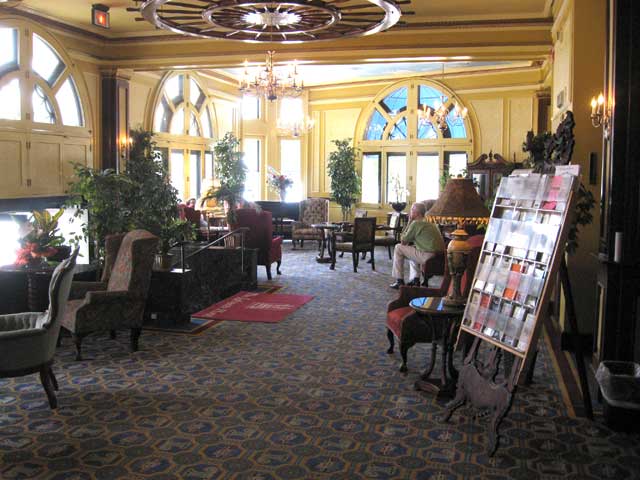 We
walked the trail across the bridge over the Muskingum River, through downtown
Marietta, and ate lunch at the historic
Lafayette Hotel. One of the last riverboat-era hotels, the
Lafayette opened on July 1, 1918, and was named in honor of the Marquis de
Lafayette, who visited the city in 1825 at a site near the hotel. He has since
been regarded as Marietta's first tourist.
We
walked the trail across the bridge over the Muskingum River, through downtown
Marietta, and ate lunch at the historic
Lafayette Hotel. One of the last riverboat-era hotels, the
Lafayette opened on July 1, 1918, and was named in honor of the Marquis de
Lafayette, who visited the city in 1825 at a site near the hotel. He has since
been regarded as Marietta's first tourist.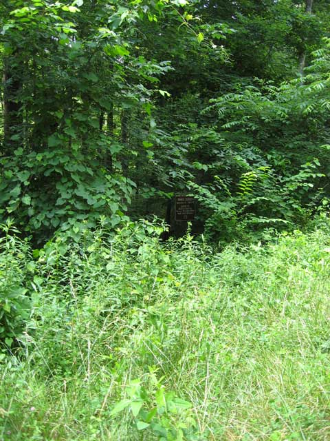
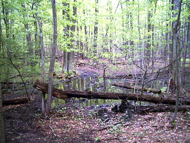
 Since
the trail had been so bad, we decided to scout it out ahead of having her
run into problems and have to back track. We drove to the trail in the
Wayne National Forest. We were only able to find two blazes which may
have been NCT blazes. We could not find where the trail went off road
at all. We did find one of the trail crossings by GPS. As you
can see in the picture it was totally overgrown with no evidence of a
"trail". If you look closely you can see a sign that says the trail is
closed during hunting season but nothing identifying it as NCT. Rather
than wandering around in the woods, she decided to just do the roads through
this area. One good thing is that there are many covered bridges to
see.
Since
the trail had been so bad, we decided to scout it out ahead of having her
run into problems and have to back track. We drove to the trail in the
Wayne National Forest. We were only able to find two blazes which may
have been NCT blazes. We could not find where the trail went off road
at all. We did find one of the trail crossings by GPS. As you
can see in the picture it was totally overgrown with no evidence of a
"trail". If you look closely you can see a sign that says the trail is
closed during hunting season but nothing identifying it as NCT. Rather
than wandering around in the woods, she decided to just do the roads through
this area. One good thing is that there are many covered bridges to
see.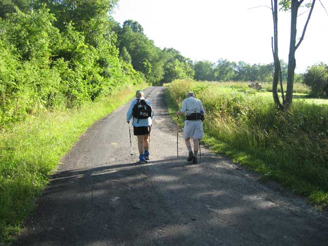 We moved to Cambridge, Oh (#10 on the map) and
stayed at Spring Valley Campground.
We moved to Cambridge, Oh (#10 on the map) and
stayed at Spring Valley Campground.
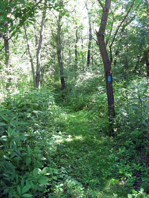
 The
trail in Salt Fork State Park was mowed and easily followed. The
mosquitoes were bad but once the hikers were back on the road they were
gone.
The
trail in Salt Fork State Park was mowed and easily followed. The
mosquitoes were bad but once the hikers were back on the road they were
gone.
 The
route we chose took them across a ridge with fabulous views. It was
also Amish country and Judy said it was some of the best hiking in Ohio.
They passed by several farms, a blacksmith shop, and two sawmills. The
church and cemetery in the picture is the burial place of the famous
baseball player Cy Young.
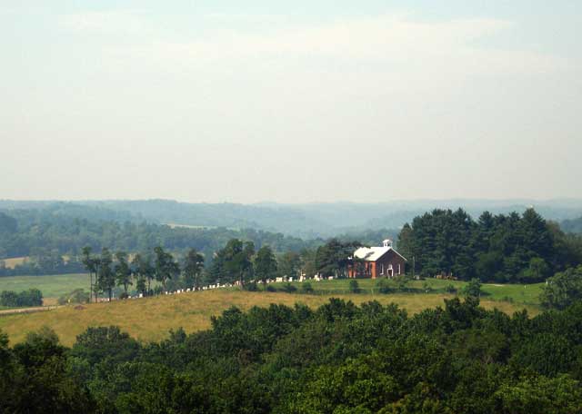
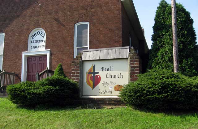
The
route we chose took them across a ridge with fabulous views. It was
also Amish country and Judy said it was some of the best hiking in Ohio.
They passed by several farms, a blacksmith shop, and two sawmills. The
church and cemetery in the picture is the burial place of the famous
baseball player Cy Young.
 The
farm where he grew up is nearby.
The
farm where he grew up is nearby. 
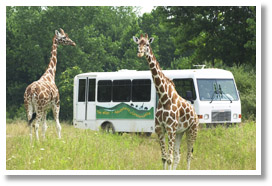
 After
Jerry left, Judy wanted a day off so were visited a place called "The
Wilds". The Wilds is one of the largest and most innovative wildlife
conservation centers in the world. Located on nearly 10,000 acres in southeast
Ohio, it is home to rare and endangered species from around the world living in
natural, open-range habitat.
After
Jerry left, Judy wanted a day off so were visited a place called "The
Wilds". The Wilds is one of the largest and most innovative wildlife
conservation centers in the world. Located on nearly 10,000 acres in southeast
Ohio, it is home to rare and endangered species from around the world living in
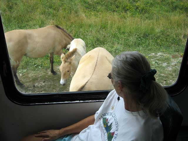
natural, open-range habitat.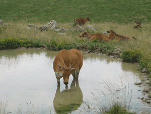 We opted for the air conditioned tour bus rather than the open air since it was
95 degrees that day!!!
We opted for the air conditioned tour bus rather than the open air since it was
95 degrees that day!!!
 On 6/28 we moved to Wood's Tall
Timber Lake Resort(#11 on the map) in New Philadelphia.
We tried to reserve a week but because of the 4th of July they were booked for
the weekend. We stayed 4 days and it cost just a few dollars less than
their weekly rate. The sites are on a hillside around the lake and are
laid out strangely. When I asked about it being a pull-thru they said it
was a pull-in. When I got there it was indeed a pull-in. Another
camper was directly in front of us, about 6 feet that is! When we left we
had to back out.
On 6/28 we moved to Wood's Tall
Timber Lake Resort(#11 on the map) in New Philadelphia.
We tried to reserve a week but because of the 4th of July they were booked for
the weekend. We stayed 4 days and it cost just a few dollars less than
their weekly rate. The sites are on a hillside around the lake and are
laid out strangely. When I asked about it being a pull-thru they said it
was a pull-in. When I got there it was indeed a pull-in. Another
camper was directly in front of us, about 6 feet that is! When we left we
had to back out. 
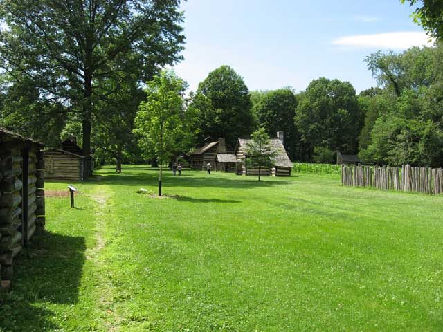 Schoenbrunn
Village was founded in 1772 by a group of Moravian missionaries and Indian
converts from Pennsylvania, and was the first white settlement in what is now
Ohio. The War for Independence spelled the end of the prospering little
community of 60 cabins, church, school, and cemetery. The Moravians had
renounced war and refused to bear arms for either side; as a result, they
suffered raids from both sides. Reverend David Zeisberger, the leader, decided
in 1777 to abandon Schoenbrunn and concentrate all the Ohio missions elsewhere.
Members of the Moravian Church relocated the forgotten village in the present
century by means of a map preserved by the mother church at Bethlehem,
Pennsylvania. The Ohio State Archaeological and Historical Society acquired the
site in 1923 and soon reconstructed a number of buildings on their original
sites.
Schoenbrunn
Village was founded in 1772 by a group of Moravian missionaries and Indian
converts from Pennsylvania, and was the first white settlement in what is now
Ohio. The War for Independence spelled the end of the prospering little
community of 60 cabins, church, school, and cemetery. The Moravians had
renounced war and refused to bear arms for either side; as a result, they
suffered raids from both sides. Reverend David Zeisberger, the leader, decided
in 1777 to abandon Schoenbrunn and concentrate all the Ohio missions elsewhere.
Members of the Moravian Church relocated the forgotten village in the present
century by means of a map preserved by the mother church at Bethlehem,
Pennsylvania. The Ohio State Archaeological and Historical Society acquired the
site in 1923 and soon reconstructed a number of buildings on their original
sites. 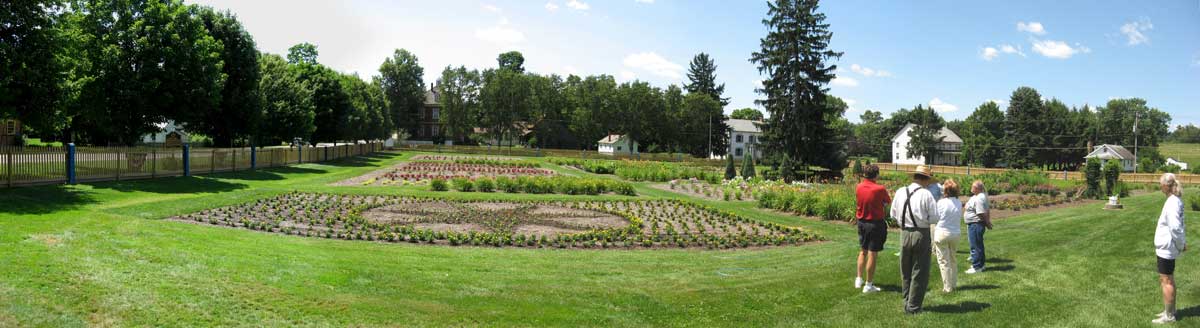
 The
trail goes right thru Zoar Village. Zoar
was founded by German religious dissenters called the Society of Separatists of
Zoar in 1817. It was a communal society, with many German-style structures that
have been restored and are part of the Zoar Village State Memorial. There are
presently ten restored buildings. Volunteers give the guided tours and
maintain the extensive gardens.
The
trail goes right thru Zoar Village. Zoar
was founded by German religious dissenters called the Society of Separatists of
Zoar in 1817. It was a communal society, with many German-style structures that
have been restored and are part of the Zoar Village State Memorial. There are
presently ten restored buildings. Volunteers give the guided tours and
maintain the extensive gardens. 
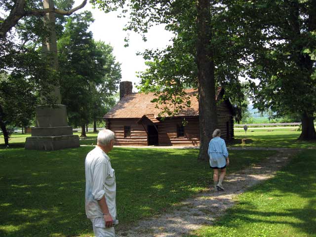
 The
trail makes a loop thru Beaver Creek
State Park.. The park is 2700 acres and has an 1830 grist mill and a
reconstructed pioneer village. The buildings are leased from the state and
operated by
The Friends of Beaver Creek SP.
Click here for a slide show of the
village
The
trail makes a loop thru Beaver Creek
State Park.. The park is 2700 acres and has an 1830 grist mill and a
reconstructed pioneer village. The buildings are leased from the state and
operated by
The Friends of Beaver Creek SP.
Click here for a slide show of the
village
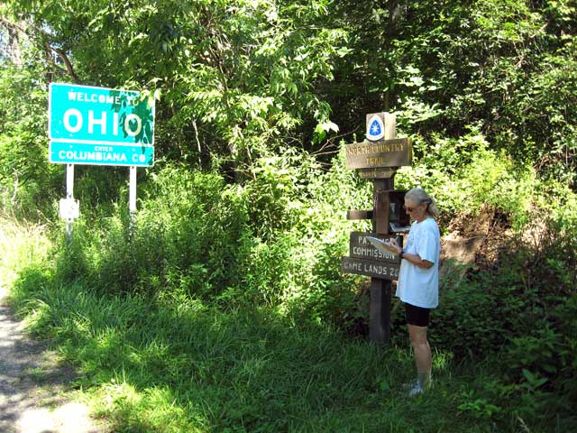
 Judy
reached the Pennsylvania border on 7/4. She was really glad to be finished
with Ohio. Why they took the trail through southern Ohio is anyone's
guess. With the high percentage of road walks and the poor condition of
what trails there are, the trail should go the shorter route via northern
Ohio. When she reached the border there were trail signs and even a trail
journal. I walked into the trail in Pennsylvania and took this picture.
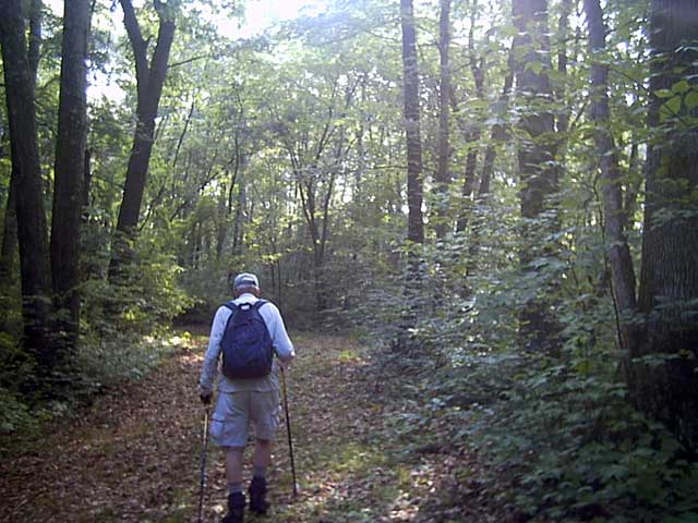
This is what a trail should look like!!!
Judy
reached the Pennsylvania border on 7/4. She was really glad to be finished
with Ohio. Why they took the trail through southern Ohio is anyone's
guess. With the high percentage of road walks and the poor condition of
what trails there are, the trail should go the shorter route via northern
Ohio. When she reached the border there were trail signs and even a trail
journal. I walked into the trail in Pennsylvania and took this picture.
This is what a trail should look like!!!
Send Email to:
bob@bgeisler.com