
THE ADVENTURES OF PLATY AND THE GANG
2006 --Phase 4 Michigan upper peninsula again
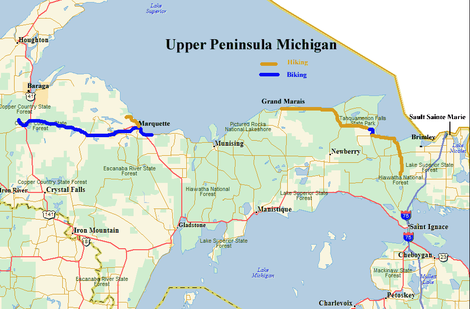
(click on the pictures for a larger view)

 On
6/17 we moved to Sault Sainte Marie. To be more exact we moved to the Bay
Mills Resort and Casino in Brimley. It's about 10 miles west.
They have a 76 site RV park along with 2 casinos, 3 restaurants, and a golf
course. A full hookup site with cable TV is only $20/night. From
here we could visit all the local sights and do a little geocaching. For a
map of this chapter click here.
On
6/17 we moved to Sault Sainte Marie. To be more exact we moved to the Bay
Mills Resort and Casino in Brimley. It's about 10 miles west.
They have a 76 site RV park along with 2 casinos, 3 restaurants, and a golf
course. A full hookup site with cable TV is only $20/night. From
here we could visit all the local sights and do a little geocaching. For a
map of this chapter click here.
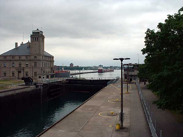
We visited the Soo Locks a couple of times and ate across the street at a great sandwich shop that served paninis. These are sandwiches grilled in a press and were excellent. Judy really like visiting the locks and watching the ships. She thought it was like watching grass grow, only less exciting.
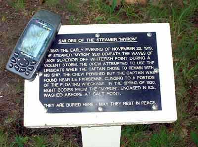
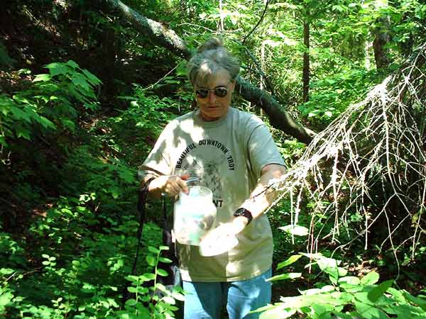
 While
we were there we did some geocaching. Some of the caches were very
interesting. One lead us to a cemetery where the crew of a wrecked ship
from 1919 were buried. Read the plaque for the story.
While
we were there we did some geocaching. Some of the caches were very
interesting. One lead us to a cemetery where the crew of a wrecked ship
from 1919 were buried. Read the plaque for the story.
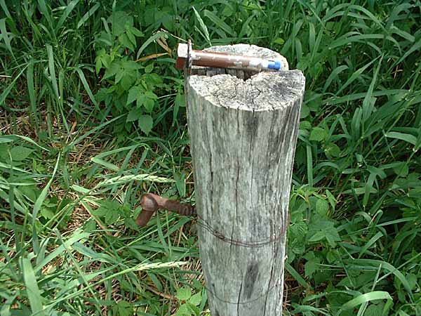
The photo at the right shows a cache that took us two trips to find. The cache is in the blue tube hidden in the bolt laying on the top of the post. The bolt was in a hole in the post. It was a clever hiding spot but rather hard to find.
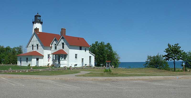 Another
cache was found near the beach next to this lighthouse. It's now a
museum.
Another
cache was found near the beach next to this lighthouse. It's now a
museum.
After staying at Bay Mills for a few days we decided to return to Baraga and spend some more time there. We had enjoyed our previous stay there (see 2006-2) and wanted to see some more things. In the meantime Jerry Groebe has contacted us and wants to return and hike some more. He will join us on July 7 in Grand Marais.
 While
at Baraga we stayed at the Ojibwa Casino
again. The restaurant there has turned out to be the best we have found on
this trip. The first night there they had a seafood buffet that included a
chef at the end of the buffet serving flaming deserts made to order. All
for $14.95. I decided I didn't want that much so the waitress recommended
the steak sandwich. First she brought me a bowl of excellent clam
chowder. When the sandwich arrived it was a 10 oz. strip sirloin on a
buttered garlic roll covered with blooming onion peels with a side of au jois.
All for $6.95. We went back 2 days later for an encore.
While
at Baraga we stayed at the Ojibwa Casino
again. The restaurant there has turned out to be the best we have found on
this trip. The first night there they had a seafood buffet that included a
chef at the end of the buffet serving flaming deserts made to order. All
for $14.95. I decided I didn't want that much so the waitress recommended
the steak sandwich. First she brought me a bowl of excellent clam
chowder. When the sandwich arrived it was a 10 oz. strip sirloin on a
buttered garlic roll covered with blooming onion peels with a side of au jois.
All for $6.95. We went back 2 days later for an encore.
Judy won $10 at the penny slots. She didn't know how to play and just kept pushing buttons. Suddenly the machine began ringing and she got a bunch of credits. She immediately cashed out and we took the tokens to the window and found out they were worth 10 bucks. That was just the beginning. More to come later.
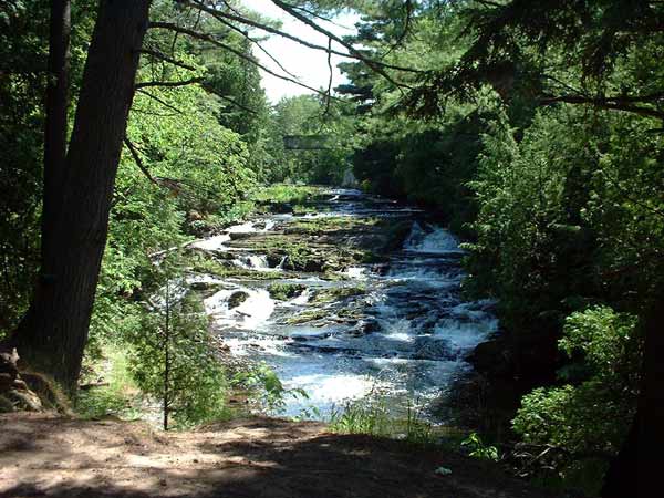
The waterfall picture is where we unsuccessfully tried to find a geocache. We had found a couple others that day but couldn't find this one. We were going to go back but never did.

 Judy
decided that it was time to return to hiking and biking. She started
south of Baraga and biked to Marquette. We moved back to Marquette and the
municipal campground. The North Country Trail in this area has a lot of
disconnected sections with either road walks in between or the connect to
nothing. She started hiking north of Marquette on one of these dead end
trails. We both hiked in about 1.5 miles to the end of the trail at the
waterfall barely visible at the left in the picture. We turned around and
hiked back out. She then hiked 3 more miles to a parking lot where I met
her and she switched to her bike for 4 more miles.
Judy
decided that it was time to return to hiking and biking. She started
south of Baraga and biked to Marquette. We moved back to Marquette and the
municipal campground. The North Country Trail in this area has a lot of
disconnected sections with either road walks in between or the connect to
nothing. She started hiking north of Marquette on one of these dead end
trails. We both hiked in about 1.5 miles to the end of the trail at the
waterfall barely visible at the left in the picture. We turned around and
hiked back out. She then hiked 3 more miles to a parking lot where I met
her and she switched to her bike for 4 more miles.
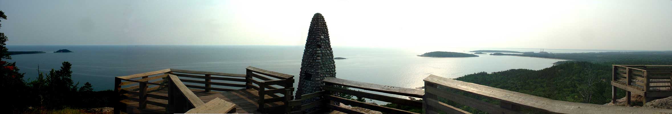
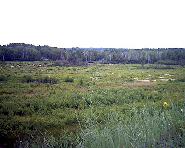
While she was hiking into town the next day I decided to hike to the top of Sugar Loaf Mountain and find a geocache located there. This is a view from the top looking out on Lake Superior with Marquette at the right. I searched for 1/2 hour and had no luck. When I checked later to see if anyone else had a problem I found out the coordinates were over 65 feet off. I had been searching in a 50 ft radius area and was not happy. There was no way I was going to climb all the way back up there!!!
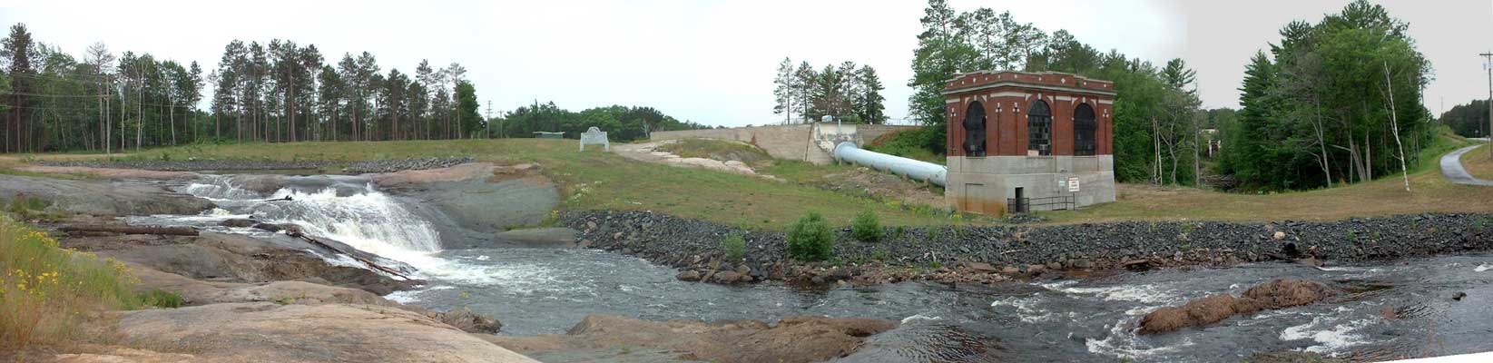
Judy
was hiking toward the campground along the lake there. Well, where the lake
was supposed to be anyway. In 2003 the dam broke and the lake isn't there
now. The left picture is the lake. The right picture is the power
house that can't generate power without water. The water used to flow out
of the spillway to the right of the power house in the trees. The water
now flows from the left of the picture where the dam used to be. The
campground is behind the trees on the left.
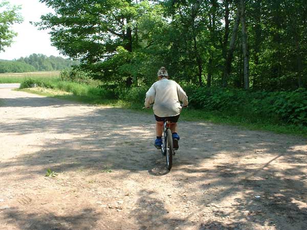
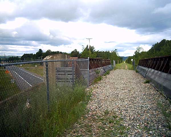 The
next day she was back on the bicycle and biked the path all along the
waterfront through the city and then on to a rail trail headed east. She stopped
here so we could move on to Grand Marais to meet Jerry on 7/7.
The
next day she was back on the bicycle and biked the path all along the
waterfront through the city and then on to a rail trail headed east. She stopped
here so we could move on to Grand Marais to meet Jerry on 7/7.
 Grand
Marais is a small harbor town on Lake Superior that is pretty isolated.
There is one main road into town from the south and gravel roads heading east
and west. There are 4 restaurants, a hardware store and 2 small grocery
stores. They do have a rather large municipal campground (114 sites)
within 2 blocks of "downtown" that is busy in the summer. We ate
at 3 of the restaurants including twice at the microbrewery.
Grand
Marais is a small harbor town on Lake Superior that is pretty isolated.
There is one main road into town from the south and gravel roads heading east
and west. There are 4 restaurants, a hardware store and 2 small grocery
stores. They do have a rather large municipal campground (114 sites)
within 2 blocks of "downtown" that is busy in the summer. We ate
at 3 of the restaurants including twice at the microbrewery.
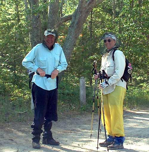
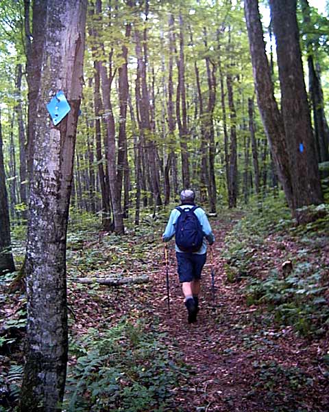
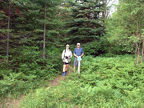 The
hikers started the next day east into the Lake Superior State Forest.
The
hikers started the next day east into the Lake Superior State Forest.
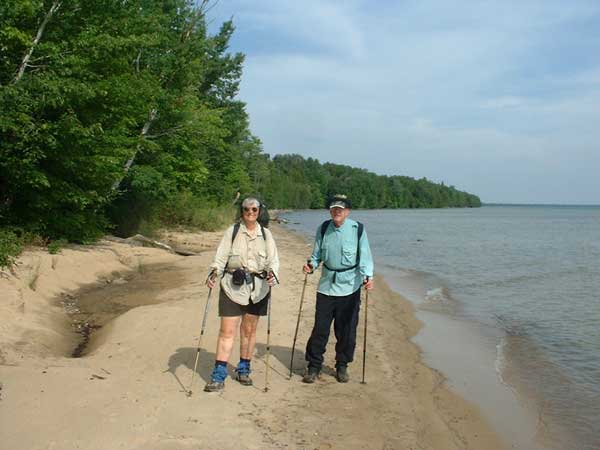
The trail is mostly along the shoreline except for where there is private
property and it circles around it. Notice the attire, shorts and short
sleeves. This will change quickly.
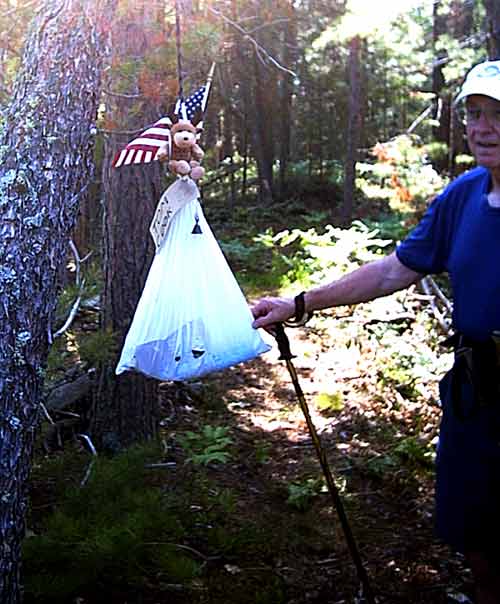
 They found the package intended for another hiker hanging from a tree along the
trail.
They found the package intended for another hiker hanging from a tree along the
trail.
They also found swarms of "killer" flies. They laugh at bug repellant
and leave red bloody spots where they bite. I pulled into a parking lot
and left my window open while I took a picture only to find dozens of them on my
seat when I returned. The problem then was how get me in the car and them
out. When the hikers got in the car they brought more swarms with
them. When Judy got out she found she had sat on 20-30 of them. The
uniform of the day was now long clothes and head nets. They still would
bite their hands. Once they got away from the shore the flies decreased
but were always a problem.

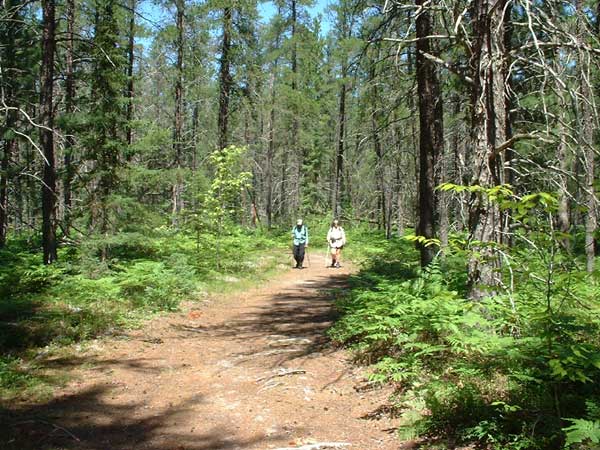
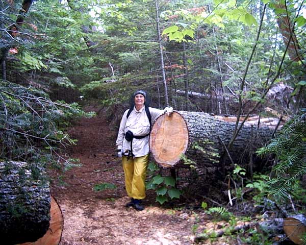 The trail in some areas was excellent like the area in the right picture
and terrible in other sections. Blown down trees sometimes would block the
trail completely. The worst areas was where no maintenance had been done
in quite a while. In some areas where a parallel road was available they
would bypass some of the worst places.
The trail in some areas was excellent like the area in the right picture
and terrible in other sections. Blown down trees sometimes would block the
trail completely. The worst areas was where no maintenance had been done
in quite a while. In some areas where a parallel road was available they
would bypass some of the worst places.
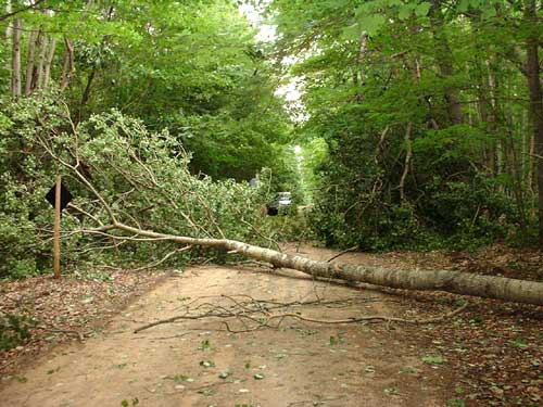
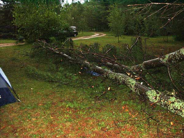 We
moved to Newberry and the North
Country Campground. The last night we were there we had a bad
thunderstorm with high winds. I had left the awning out and at 6:00 in the
morning a blast of wind felt like it wound tear the awning off or turn the RV
over. I went out in the pouring rain and tried to roll it up only to have
it stop about 3 ft from being closed. All I could do was push it against
the coach and latch it there. Luckily the one blast was all we had and
when the rain stopped I was able to open it back up and it re-rolled
correctly. Others in the campground were not so lucky. Two trailers
had their awnings totally destroyed. Several large trees were uprooted and
more were snapped off. The picture is of a 12" dia. tree that was blown
over onto a tent. It's the blue thing under the tree. Luckily the
people had left the tent and had gotten into their car.
We
moved to Newberry and the North
Country Campground. The last night we were there we had a bad
thunderstorm with high winds. I had left the awning out and at 6:00 in the
morning a blast of wind felt like it wound tear the awning off or turn the RV
over. I went out in the pouring rain and tried to roll it up only to have
it stop about 3 ft from being closed. All I could do was push it against
the coach and latch it there. Luckily the one blast was all we had and
when the rain stopped I was able to open it back up and it re-rolled
correctly. Others in the campground were not so lucky. Two trailers
had their awnings totally destroyed. Several large trees were uprooted and
more were snapped off. The picture is of a 12" dia. tree that was blown
over onto a tent. It's the blue thing under the tree. Luckily the
people had left the tent and had gotten into their car.
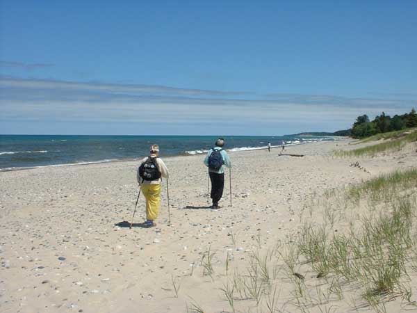
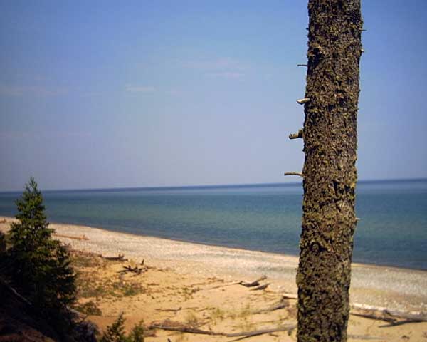
 While
they were hiking along one sandy shore section Jerry said that no one would swim
in the lake because of the cold water. Well, I showed him. I put on
my trunks and tried it. The water wasn't bad because it was shallow for over 100
yards from shore. The sun warmed it up but once I got out I had to get
dressed quickly to escape the flies.
While
they were hiking along one sandy shore section Jerry said that no one would swim
in the lake because of the cold water. Well, I showed him. I put on
my trunks and tried it. The water wasn't bad because it was shallow for over 100
yards from shore. The sun warmed it up but once I got out I had to get
dressed quickly to escape the flies.
 From
Lake Superior shore the trail turns south towards the Mackinaw Bridge.
From
Lake Superior shore the trail turns south towards the Mackinaw Bridge.
 The
windstorm also blew over a lot of trees in the forest. This road was
blocked so I wasn't able to meet them at on of the road crossings. I did
meet them later for a lunch and water break.
The
windstorm also blew over a lot of trees in the forest. This road was
blocked so I wasn't able to meet them at on of the road crossings. I did
meet them later for a lunch and water break. 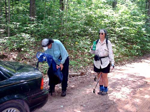
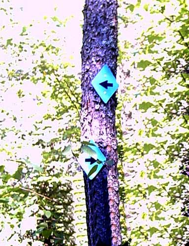
Sometimes the trail wasn't well marked and confusing. This picture
shows the problem well. Which way do we go???
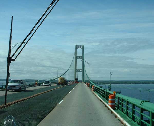 Jerry had to return home. His 2 week pass from his wife had expired.
We also decided to head south across the Mackinaw Bridge and return next
year. We are going to go to Grayson Highlands State Park in
Virginia.
Jerry had to return home. His 2 week pass from his wife had expired.
We also decided to head south across the Mackinaw Bridge and return next
year. We are going to go to Grayson Highlands State Park in
Virginia.