
THE ADVENTURES OF PLATY AND THE GANG
2005
Volume 3- North Dakota and the North Country Trail
On Friday, April 8th we started north towards North Dakota. When we got to Gainesville, Fl, I noticed the parking brake light on the dash was lit. This also happened a couple of years ago. I exited the interstate and stopped a gas station with a mechanic. They couldn't help so I called Workhorse and asked where the nearest dealer was. They directed me to a Chevy dealer in Lake City. I called them and they said they were busy and it would take a week. I told them that I had had this happen before and that it takes 15 minutes to fix. The girl said that they didn't have the part and had to order it from Workhorse. I told her that it was a Chevy part and that they probably had it in stock but she said Workhorse wouldn't allow it. Since I had the Chevy part number she reluctantly switched me to the parts department. They had it in stock. We drove there and I bought it ($26). We then drove further up I-75 to White Springs where there is a large vacant parking lot. We had lunch and I crawled underneath and fixed it myself. I think I will carry another switch as a spare.
 We
spent 7 days traveling the 2200 miles to Lake Sakakawea State Park in central
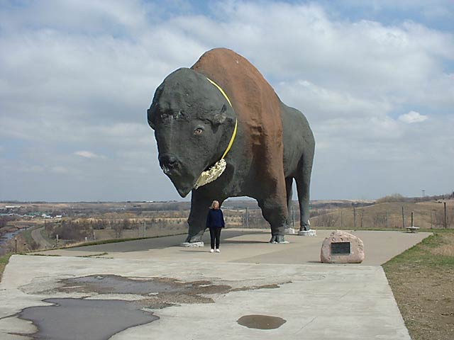
North Dakota. Along the way we saw the worlds largest bison in Jamestown,
ND and stopped at the Lewis and Clark Interpretive Center ( www.fortmandan.com
).
We
spent 7 days traveling the 2200 miles to Lake Sakakawea State Park in central
North Dakota. Along the way we saw the worlds largest bison in Jamestown,
ND and stopped at the Lewis and Clark Interpretive Center ( www.fortmandan.com
). 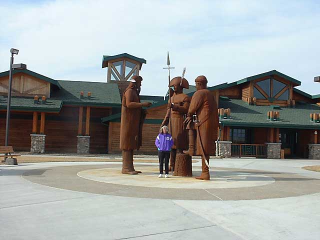
 Fort
Mandan is where Lewis and Clark spent the first winter of their expedition (1804-1805)
and where they met Sacajawea (also known as Sakakawea).
Fort
Mandan is where Lewis and Clark spent the first winter of their expedition (1804-1805)
and where they met Sacajawea (also known as Sakakawea).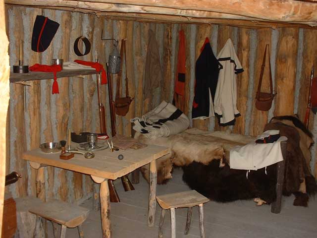
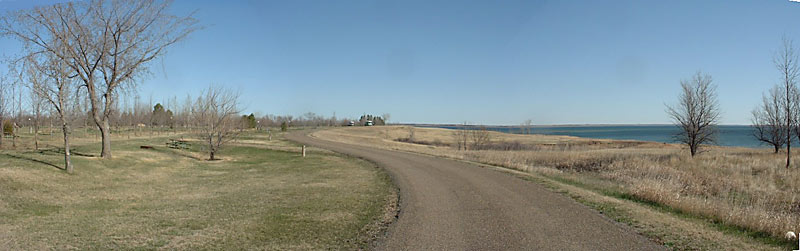
Lake Sakakawea is the largest Corps of Engineers reservoir in the U.S.
The lake is 178 miles long and six miles wide at its widest point. The
state park is located on the southern side of the lake and has 300 camping
sites. When we arrived John and Adele were the only campers there.
http://www.ndparks.com/Parks/LSSP.htm
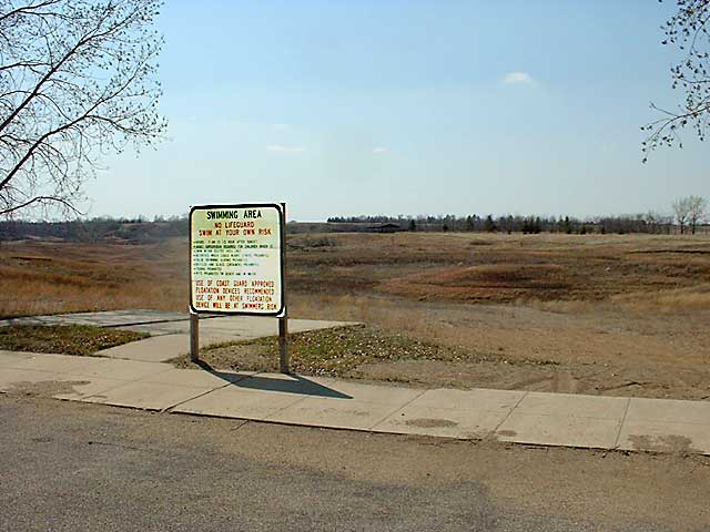 The
area has had droughts and the lake is down 41 feet and lower than it has been
since it was built in 1954. This is a picture I took of the swimming beach that
is normally right behind the sign. The water is now about a half mile left
of the picture.
The
area has had droughts and the lake is down 41 feet and lower than it has been
since it was built in 1954. This is a picture I took of the swimming beach that
is normally right behind the sign. The water is now about a half mile left
of the picture.
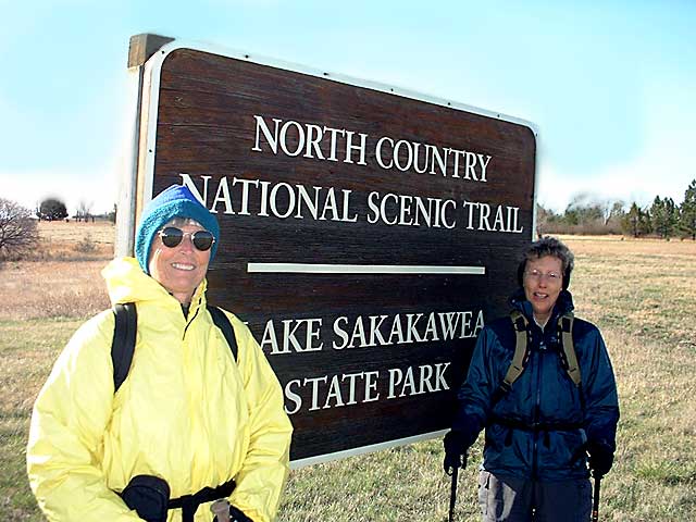
Adele and Judy started hiking the day after we arrived. The western end
of the North Country Trail is next to the park's visitor center. From
there the trail travels about 2 miles in the park and then across the dam for
the lake.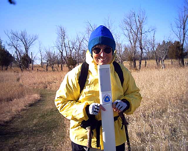
The next few days was hiking on gravel roads through rural North Dakota. 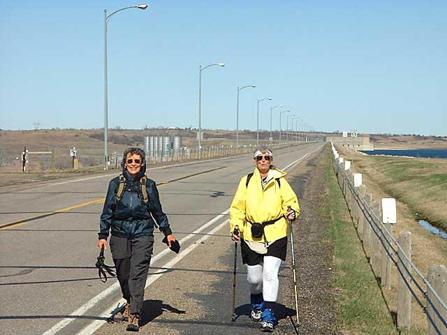
 In
one area they hiked a scenic auto tour road through the Audubon National
Wildlife Refuge. This 160,000 acre complex is a in a bird migration
area. John's red truck can be seen in the distance. He enjoys bird
watching and got to do a lot of it while waiting to meet the girls.
In
one area they hiked a scenic auto tour road through the Audubon National
Wildlife Refuge. This 160,000 acre complex is a in a bird migration
area. John's red truck can be seen in the distance. He enjoys bird
watching and got to do a lot of it while waiting to meet the girls.
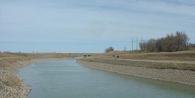
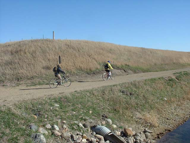 The
next section of trail parallels the McCluskey Canal. This is a part of a
series of canals that have been built to irrigate farms in central ND.
They were partially completed but because of funding and environmental concerns
the haven't been completed. For the next 70 miles there are maintenance roads
along the canal the trail follows. On a couple of days they biked for a
change of pace.
The
next section of trail parallels the McCluskey Canal. This is a part of a
series of canals that have been built to irrigate farms in central ND.
They were partially completed but because of funding and environmental concerns
the haven't been completed. For the next 70 miles there are maintenance roads
along the canal the trail follows. On a couple of days they biked for a
change of pace.
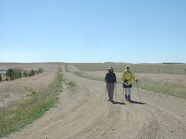 This
area of ND is nothing but rolling farmland. The only trees are around the
farmhouses. The fields are huge. The only roads that are paved are
the state highways. The rest of the area is a grid of gravel county
roads every mile or so. It's easy to get lost because there are no road
signs. You can see someone coming for miles by their dust plume.
This
area of ND is nothing but rolling farmland. The only trees are around the
farmhouses. The fields are huge. The only roads that are paved are
the state highways. The rest of the area is a grid of gravel county
roads every mile or so. It's easy to get lost because there are no road
signs. You can see someone coming for miles by their dust plume.

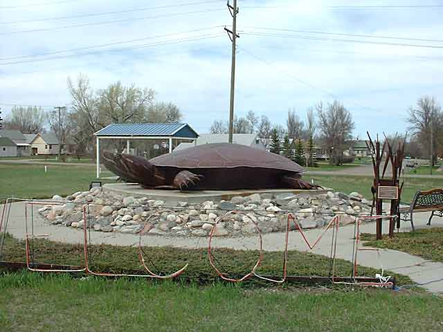 We
stayed for a week in the town of McCluskey (pop. 600). Their claim to fame is
that they are the geographical center of ND. Adele says it's also the
middle of nowhere. The motel has 10 units
and 6 RV sites. We were the only RVs there along with one mail truck
driver ( the white truck in the picture) who has a permanent room where he
sleeps for a few hours each afternoon while waiting to make his return trip to
Jamestown in the evening. The town has a grain elevator, 2 bar/cafes, one
grocery store and 1.5 gas stations ( one station has no attendant just a credit
card machine.) The closest town is Turtle Lake, similar to McCluskey
30 miles away. They have a 2 ton turtle named Rusty.
We
stayed for a week in the town of McCluskey (pop. 600). Their claim to fame is
that they are the geographical center of ND. Adele says it's also the
middle of nowhere. The motel has 10 units
and 6 RV sites. We were the only RVs there along with one mail truck
driver ( the white truck in the picture) who has a permanent room where he
sleeps for a few hours each afternoon while waiting to make his return trip to
Jamestown in the evening. The town has a grain elevator, 2 bar/cafes, one
grocery store and 1.5 gas stations ( one station has no attendant just a credit
card machine.) The closest town is Turtle Lake, similar to McCluskey
30 miles away. They have a 2 ton turtle named Rusty.
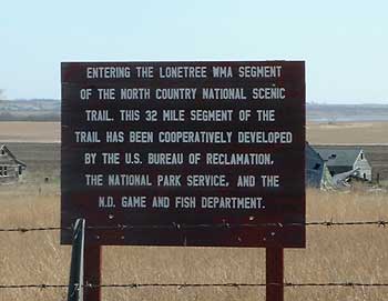 The
next section of trail is through the Lonetree Wildlife Management Area.
The trail is marked by posts but has not been mowed or traveled enough to make a
path.
The
next section of trail is through the Lonetree Wildlife Management Area.
The trail is marked by posts but has not been mowed or traveled enough to make a
path. 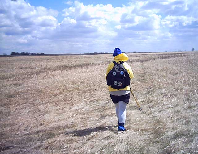
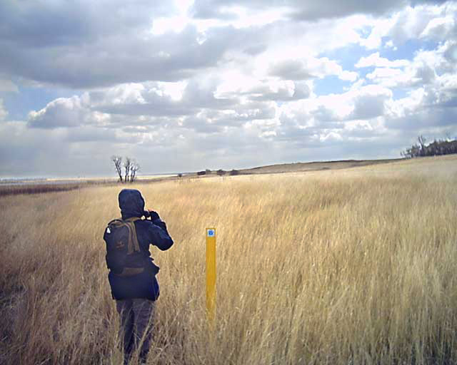 In
some places Adele would stop and get out her binoculars to try to find the next
post. The grass was sometimes higher than the posts. The wind has
started up again. The forecast for the next week is 20-30 mph winds out of
the north, highs in the 40's and lows in the 20's. We had snow flurries
today when we moved the RV to Harvey, ND.
In
some places Adele would stop and get out her binoculars to try to find the next
post. The grass was sometimes higher than the posts. The wind has
started up again. The forecast for the next week is 20-30 mph winds out of
the north, highs in the 40's and lows in the 20's. We had snow flurries
today when we moved the RV to Harvey, ND.