The Adventures of Platy and the Gang

|
2003 Volume 12
|
|
|
|
2003 Volume 12
|
|
The Katy Trail State Park, built on the former corridor of the Missouri-Kansas-Texas Railroad (MKT or Katy), is 225 miles long and runs from Clinton to St. Charles with 26 trail heads and two fully restored depots along the way. The section of trail between Boonville and St. Charles has been designated as an official segment of the Lewis and Clark National Historic Trail. Katy Trail is also part of the American Discovery Trail and has been designated as a Millennium Legacy Trail.
Trail users get the opportunity to wind through some of the most scenic areas of the state with the majority of the trail closely following the route of the Missouri River. The park also takes users through a slice of rural history as it meanders through the small towns that once thrived along the railroad corridor and reflect the rich heritage of Missouri.
Between 1865 and 1915, an extensive railroad system extending through Missouri, Kansas, Oklahoma and Texas was developed, eventually known as the Missouri-Kansas-Texas Railroad (MKT or Katy). As the railroad expanded through Missouri, towns developed along its path. For many years, the Katy was the hub of these towns.
When the railroad decided to cease operation on its route from Machens in St. Charles County to Sedalia in Pettis County in 1986, it presented the chance to create a unique recreational opportunity. The opportunity for the Missouri Department of Natural Resources to acquire the fight-of-way was made possible by the National Trails Systems Act, which provides that railroad corridors no longer needed for active rail service can be banked for future transportation needs and used on an interim basis for recreational trails. Because of a generous donation by the late Edward D. "Ted" Jones, the department was able to secure the right-of-way and construct the trail. In 1991, The Union Pacific Railroad donated an additional 33 miles of rail corridor from Sedalia to east of Clinton. Additional purchases and donations have been added and today, Katy Trail State Park extends 225 miles from Clinton to St. Charles. The department plans to construct the trail to the end of the original corridor near the small rail town of Machens.
The Trailhead at Clinton
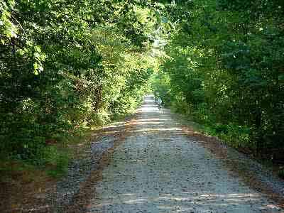
The first couple of days from Clinton to Sedalia are in areas that they are trying to restore the prairie. They have cut the trees and with no shade it is hot . We liked the shady areas better. From Sedalia to Rocheport we traveled through rolling farm fields in the trees on the railroad right of way. Corn fields, soy beans and cattle (stinky). In one place a farmer had used the trail to haul manure to his fields. His spreader leaked all along the trail.
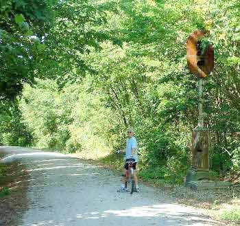
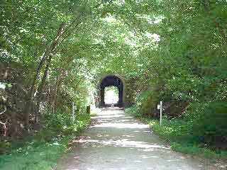
This is the last remaining signal light. We waited but it never gave us a green light. I guess that's because the lamps were all broken and the wires were cut. We went on anyway. This is the only tunnel on the trail just outside of Rocheport.
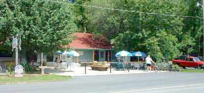 There are small towns all along. Some have tried to attract bikers and have built businesses they need. There are bike shops, campgrounds, stores, and restaurants you can stop at. This cafe/bike shop is in Rocheport. We had lunch there after we had finished for the day. We tried to eat at the local places whenever we could. (And I remembered to bring my money.)
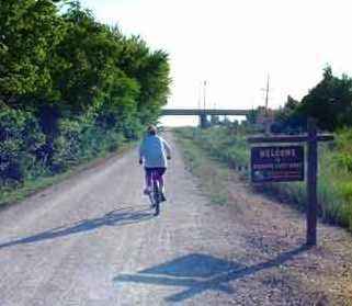
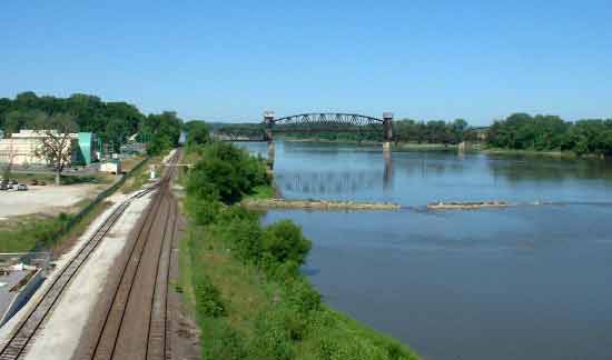
The Katy Trail runs along the Missouri River for over 2/3's of it's length. This area is part of the Lewis and Clark Trail that is having it's 200th anniversary. It's also a part of The American Discovery Trail that runs from coast to coast.
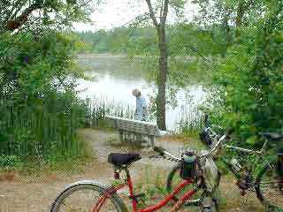
We stopped at one of the benches along the river for a break. In some areas the river is on one side and high bluffs are on the other. In some areas it's 15 miles between towns or trailheads. We would park the RV at one end and the car at the other. At the end of the day we would have to drive back and pick up the other vehicle. We biked from 25 to 35 miles a day and drive 60 to 160 to drop off and pick up. We did buy a second bike rack for the RV so we would have one on both ends.
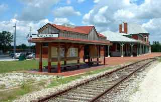
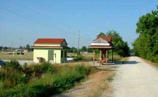
Two towns have restored depots. Sedalia has just finished a museum showing the railroads history in that town. At one time the locomotive shops there employed 1800 people. Now there are none. At New Franklin we stayed at a campground where there used to be a roundhouse. The turntable is all that is left. It employed 1000 people.
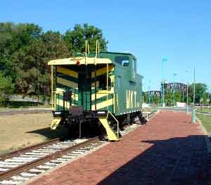
At Boonville they have restored their depot and a caboose. In the background you can see the old drawbridge across the Missouri. The Trail doesn't cross there anymore but detours across the highway bridge.
After we finished the Katy Trail we started driving across country to West Virginia. We are going to finish the Greenbriar Trail we started a couple of years ago and whatever else we can find.